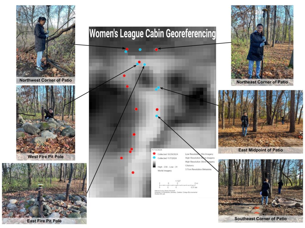
Click the double arrow in the top right corner to see the legends of the georeferencing work on the Cabin site. The black-and-white background is an aerial photo of Dakota County taken in 1951, which captures the Arb and the Women’s League Cabin. As a result of georeferencing, the floor plan hand-drawn by D.B. Stewart in 1937 was overlain on top of the aerial photo. The Yellow Main Floor Outline was drawn manually on ArcGIS Pro. We first located the northeast corner of the patio, measured the distances between segment ends on paper, and then used the floor plan scale (approximately 1:96.2) to obtain the actual physical distances between control points. This was how we located the northeast corner of the main floor, as we had been unable to find its location out in the field due to the lack of architectural features on the surface. For georeferencing purposes, we cropped out the bottom right corner of the floor plan because that part depicted the basement, which was below ground level and thus not necessary for mapping the site’s location.